

Accurate surveying is the foundation of successful construction, infrastructure development, and engineering projects across the United Kingdom. Whether planning a new commercial building, upgrading an existing industrial facility, or developing essential infrastructure, reliable site measurements are crucial for making informed decisions. Professional Surveying Services provide the precise spatial data needed to support project planning, minimise errors, and improve construction efficiency.
As construction projects become increasingly complex, traditional measurement techniques alone may not always meet modern engineering requirements. Consequently, advanced technologies such as 3D laser scanning, LiDAR surveying, drone surveys, and digital mapping are transforming how engineers, architects, and contractors collect and interpret site information. These innovative methods help capture detailed measurements, create accurate digital representations, and identify potential design challenges before construction begins.
Furthermore, modern surveying plays an important role in Building Information Modelling (BIM) and digital engineering. By integrating reliable survey data into 3D models, project teams can improve collaboration, enhance design coordination, and reduce the risk of costly construction changes. This approach is particularly valuable for complex infrastructure, water treatment facilities, industrial environments, and refurbishment projects where understanding existing site conditions is essential.
However, choosing the right surveying method depends on several factors, including project size, site accessibility, accuracy requirements, and budget. Understanding the available technologies and their applications can therefore help businesses select cost-effective solutions without compromising data quality.
In this comprehensive guide, we explore the different types of surveying services available in the UK, the technologies used, key cost considerations, and the benefits they offer. We also explain how professional surveying supports modern construction workflows and how businesses can choose the right surveying solutions for their projects.
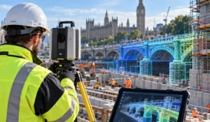
What Are Surveying Services and Why Are They Important?
Surveying Services involve the professional measurement, mapping, and analysis of land, buildings, structures, and infrastructure to provide accurate spatial information. These services help architects, engineers, contractors, and developers understand existing site conditions, make informed design decisions, and plan construction activities efficiently. In the UK, surveying is essential for supporting safe, accurate, and well-coordinated construction and engineering projects.
Understanding Professional Surveying in Construction and Engineering
Professional surveying involves collecting precise measurements and geographical information to establish the physical characteristics of a site or structure. Depending on the project’s requirements, surveyors use technologies such as total stations, GNSS equipment, 3D laser scanners, and LiDAR systems to capture reliable data.
Furthermore, modern surveying goes beyond traditional land measurement. Advanced digital techniques enable professionals to create detailed topographical maps, 3D point clouds, and accurate representations of existing buildings and infrastructure. These outputs provide valuable information for design development, engineering assessments, and Building Information Modelling (BIM).
For example, when upgrading an operational water treatment facility, 3D laser scanning can capture the positions of existing equipment, pipework, and structural elements. Engineers can then use this information to plan modifications while reducing the risk of dimensional conflicts.
Why Accurate Survey Data Matters for UK Construction Projects
Accurate survey information plays a critical role throughout the construction lifecycle, from initial feasibility assessments to project completion. Without reliable measurements, design teams may encounter unexpected site constraints, incorrect dimensions, and coordination challenges that increase project costs.
Moreover, professional surveying helps identify potential problems before construction begins. By understanding existing ground levels, structural layouts, and infrastructure locations, project teams can develop more practical designs and improve resource planning.
Reliable survey data also supports compliance with relevant project specifications and technical standards. Additionally, it improves communication between architects, civil engineers, mechanical designers, and contractors by providing a consistent understanding of site conditions.
As a result, investing in accurate surveying at an early stage can help minimise unnecessary rework, improve project efficiency, and support better decision-making.
Who Needs Professional Surveying Services?
Professional surveying is valuable across multiple sectors, particularly where accurate site measurements are essential for engineering design and construction.
Construction companies rely on survey information for site preparation, setting out, and verifying completed works. Similarly, architects and property developers use measured building and topographical surveys to understand existing conditions before preparing designs.
Civil engineers require accurate spatial data for infrastructure development, drainage systems, roads, and utilities. Meanwhile, industrial operators and water treatment organisations often depend on advanced scanning technologies to plan equipment upgrades, facility modifications, and maintenance activities.
Furthermore, organisations implementing BIM workflows benefit from survey-generated point clouds and digital models that represent existing site conditions.
Ultimately, the primary value of professional surveying lies in reducing uncertainty and providing reliable information that supports safer, more efficient, and better-coordinated projects.
What Are the Different Types of Surveying Services Available in the UK?
The UK construction and engineering industries rely on several types of Surveying Services to collect accurate information about land, buildings, and existing infrastructure. Each surveying method serves a specific purpose, depending on the project’s complexity, required accuracy, site conditions, and intended application.
Furthermore, advances in surveying technology have introduced faster and more detailed data capture methods, enabling engineers and construction professionals to make better-informed decisions. Understanding these different approaches helps businesses choose the most appropriate solution for their projects.
Topographical Surveying
Topographical surveying involves measuring and mapping the physical features of a site, including ground levels, slopes, boundaries, existing structures, roads, and visible utilities. It provides essential information for understanding site conditions before design or construction activities begin.
In the UK, topographical surveys are widely used in residential developments, commercial construction, civil engineering, and infrastructure projects. For example, engineers rely on accurate ground-level information when designing drainage systems, access roads, and foundations.
Additionally, topographical data can be integrated into CAD drawings and digital terrain models, allowing project teams to assess site constraints and plan construction activities more effectively.
3D Laser Scanning and LiDAR Surveying
3D laser scanning and LiDAR surveying are advanced measurement techniques that use laser technology to capture detailed spatial information about buildings, structures, and surrounding environments.
These systems collect large numbers of measurement points, creating a digital dataset known as a point cloud. This information can be processed to develop accurate 3D representations of existing structures and engineering installations.
Unlike traditional measurement methods, laser scanning can capture complex geometries and extensive surface details efficiently. Consequently, it is particularly valuable for refurbishment projects, industrial facilities, mechanical installations, and infrastructure upgrades.
For instance, when modifying an existing wastewater treatment facility, engineers can use laser scanning to document pipework, machinery, structural components, and available installation space. The resulting point cloud can then support BIM modelling, helping designers identify potential clashes before work begins.
Moreover, laser scanning can reduce the need for repeated manual measurements, particularly in complex or difficult-to-access environments.
Drone and Aerial Surveying
Drone surveying uses unmanned aircraft equipped with cameras or specialised sensors to collect aerial imagery and spatial information. It is particularly useful for surveying large construction sites, infrastructure corridors, rooftops, and locations that are difficult to access from the ground.
Through photogrammetry, overlapping aerial photographs can be processed into orthomosaic maps, 3D surface models, and other digital outputs. Alternatively, drones equipped with LiDAR sensors can collect laser-based measurements.
Furthermore, aerial data capture can reduce the amount of time personnel need to spend in potentially hazardous or inaccessible areas.
However, drone operations must comply with applicable UK Civil Aviation Authority requirements. Factors such as airspace restrictions, weather conditions, flight permissions, and site-specific risks must be considered before a survey begins.
Measured Building Surveys
Measured building surveys provide detailed information about the dimensions, layouts, and physical characteristics of existing buildings. These surveys commonly produce floor plans, elevations, sections, and other architectural documentation.
They are especially important for renovation, refurbishment, extensions, and redevelopment projects where original drawings may be outdated or unavailable.
Additionally, modern measured building surveys often incorporate 3D laser scanning to capture internal spaces, structural elements, and building geometry. The collected information can then be converted into CAD drawings or BIM models.
As a result, architects and engineers gain a more reliable understanding of existing conditions, reducing uncertainty during design development.
Engineering and Construction Surveys
Engineering and construction surveying focuses on providing accurate measurements and positioning information throughout the construction process.
These surveys support activities such as setting out foundations, positioning structural components, establishing control points, and verifying completed construction work.
For example, civil engineers use construction surveys to ensure that roads, drainage systems, structural elements, and mechanical installations are positioned according to approved designs.
Furthermore, as-built surveys document the actual positions and dimensions of completed work. This information is valuable for project handover, quality assurance, future maintenance, and asset management.
By maintaining reliable measurement data throughout the project lifecycle, construction teams can improve coordination and identify dimensional discrepancies before they become significant problems.
Underground Utility Surveys
Underground utility surveying involves identifying and mapping buried infrastructure, including water pipes, drainage systems, electrical cables, gas pipelines, and telecommunications networks.
These surveys often use techniques such as ground-penetrating radar (GPR), electromagnetic detection, and existing utility records to locate potentially hidden services.
In the UK, underground utility investigations are commonly undertaken with reference to PAS 128, which provides a framework for specifying and carrying out underground utility detection, verification, and location.
Accurate utility information is particularly important before excavation or groundworks. It helps project teams identify potential hazards, minimise accidental service damage, and plan construction activities more safely.
Nevertheless, underground survey findings can have varying levels of confidence, and not every buried service can be detected using non-intrusive methods. Therefore, the limitations of the survey should always be considered during project planning.
Ultimately, selecting the right survey type depends on the project’s technical requirements, physical environment, and intended deliverables. In many cases, combining traditional surveying methods with LiDAR, 3D laser scanning, drone technology, and BIM workflows provides a more complete understanding of existing site conditions.
As surveying methods continue to evolve, modern digital technologies are transforming how spatial information is captured, processed, and integrated into construction and engineering projects.
Modern Surveying Technologies Transforming the UK Construction Industry
The construction and engineering industries in the United Kingdom are experiencing significant advancements in how spatial information is collected, analysed, and used. Modern Surveying Services increasingly incorporate technologies such as Light Detection and Ranging (LiDAR), unmanned aerial vehicles (UAVs), Global Navigation Satellite Systems (GNSS), and Building Information Modelling (BIM) to improve measurement efficiency and support accurate project planning.
Unlike conventional approaches that focus on selected measurement points, advanced digital technologies can capture extensive spatial datasets and create detailed representations of existing environments. Consequently, engineers, architects, and construction professionals can gain a better understanding of site conditions before making critical design decisions.
Furthermore, combining different surveying technologies enables project teams to develop more reliable digital records, improve coordination, and manage complex construction activities more effectively.
How Does LiDAR Technology Improve Survey Accuracy?
LiDAR (Light Detection and Ranging) is a remote sensing technology that uses laser pulses to measure distances between a sensor and surrounding objects. By collecting numerous measurements, LiDAR systems generate detailed three-dimensional point clouds representing the physical geometry of buildings, structures, and landscapes.
One of the main advantages of LiDAR surveying is its ability to capture complex environments with a high level of detail. For example, traditional measurement techniques may require individual measurements of equipment, structural components, and pipework. In contrast, terrestrial laser scanning can capture extensive surface geometry from multiple scanning positions.
Additionally, LiDAR technology is particularly useful in industrial facilities, water treatment plants, and existing infrastructure where accurate measurements are essential for planning modifications or installing new equipment.
However, measurement accuracy depends on factors such as equipment specifications, scanning distance, surface characteristics, environmental conditions, and survey control. Therefore, professional data processing and quality verification remain essential.
The Role of Drones and Photogrammetry in Modern Surveying
Drone technology has introduced new possibilities for capturing spatial information across large or difficult-to-access sites. Equipped with high-resolution cameras or LiDAR sensors, drones can collect detailed aerial data without requiring surveyors to physically access every part of the surveyed area.
Photogrammetry involves processing overlapping photographs taken from different positions to reconstruct three-dimensional information. This technique can generate orthomosaic maps, digital surface models, and 3D representations suitable for construction planning and site assessments.
For instance, drone surveying can support monitoring of construction progress, assessing earthworks, and documenting infrastructure conditions. Moreover, it can provide a broader overview of a site, helping engineers identify spatial relationships that may be difficult to assess from ground level.
Nevertheless, drone-based surveys are not suitable for every situation. Dense vegetation, restricted airspace, poor weather, and limited visibility can affect data collection. As a result, aerial methods are often combined with ground-based surveying to produce more complete and reliable datasets.
How GPS, GNSS and Total Stations Support Modern Surveys
Accurate positioning forms the foundation of reliable surveying information. Technologies such as GNSS and total stations help surveyors establish coordinates, measure distances, and maintain consistent spatial references across construction sites.
Although the terms GPS and GNSS are sometimes used interchangeably, GPS refers specifically to the United States satellite navigation system, while GNSS includes multiple global satellite constellations.
GNSS equipment is widely used for establishing survey control and collecting positioning information in suitable outdoor environments. Meanwhile, total stations measure angles and distances to determine precise positions, making them valuable for construction setting out, engineering surveys, and dimensional verification.
Furthermore, these technologies play an important role in connecting data collected by different surveying methods. For example, survey control can help align terrestrial laser scanning information with other site measurements and project coordinate systems.
By integrating consistent positioning information, project teams can reduce alignment errors and improve the reliability of drawings, models, and construction records.
From Point Clouds to BIM and Digital Twins
One of the most valuable developments in digital surveying is the ability to connect captured spatial information with Building Information Modelling (BIM) and digital engineering workflows.
Modern laser scanning systems generate point clouds containing millions of measured points that represent existing physical conditions. However, a point cloud alone does not automatically provide the structured engineering information required for BIM.
Instead, specialists process and interpret this data to develop digital models representing relevant building elements, structural components, mechanical systems, and infrastructure assets.
For example, when upgrading a wastewater treatment facility, engineers can use laser scanning data to create an as-existing model showing equipment positions, pipework routes, and available installation space. This model can then support the design of new mechanical systems and help identify potential spatial conflicts before installation.
Furthermore, survey-informed BIM models can contribute to the development of digital twins when connected with suitable operational information and maintained to reflect changes in the physical asset.
A digital twin goes beyond static 3D geometry by representing an asset and using relevant data to support monitoring, analysis, or operational decisions. Therefore, accurate surveying provides an important starting point, although additional systems and ongoing information management are necessary.
Why Integrating Multiple Surveying Technologies Matters
While each surveying technology offers distinct advantages, no single method is suitable for every construction or engineering project.
For example, drone surveys may provide extensive aerial coverage, while terrestrial laser scanning captures detailed information about equipment and structures. Similarly, GNSS and total stations can establish reliable control points to connect datasets within a consistent coordinate framework.
Combining these methods allows surveying professionals to select the most appropriate tools for different site conditions and project requirements.
Ultimately, the value of modern surveying technology lies not simply in collecting more data, but in producing accurate, relevant, and usable information that supports engineering design, construction coordination, and long-term asset management.
However, selecting the latest technology is not always the most cost-effective approach. Understanding the differences between traditional and digital surveying methods can help organisations choose solutions that deliver the right balance of accuracy, efficiency, and project value.
Traditional Surveying vs Digital Surveying: Which Is Better?
Choosing between traditional and digital surveying methods is an important decision for construction companies, engineers, and infrastructure developers. Both approaches provide valuable spatial information; however, their suitability depends on project requirements, site complexity, accuracy expectations, and available budgets.
Traditional surveying typically uses instruments such as total stations, levels, and GNSS receivers to collect measurements at selected locations. In contrast, digital Surveying Services often incorporate technologies such as 3D laser scanning, LiDAR, photogrammetry, and drone-based data capture to generate detailed spatial datasets.
Although digital technology offers significant advantages for complex environments, traditional methods remain highly effective for construction setting out, survey control, and targeted measurements. Therefore, understanding their differences is essential for selecting the most practical and cost-effective solution.
Comparing Accuracy, Efficiency, Cost and Applications
Traditional and digital surveying methods differ primarily in how information is collected, processed, and delivered. While conventional techniques provide precise measurements at specific points, modern scanning technologies can capture extensive surface geometry and produce detailed digital representations.
The following table highlights the key differences:
| Comparison Factor | Traditional Surveying | Digital Surveying |
|---|---|---|
| Data Collection | Measurements at selected points | Dense spatial datasets and 3D information |
| Equipment | Total stations, levels, GNSS | 3D laser scanners, LiDAR, drones |
| Accuracy | High accuracy for targeted measurements | High accuracy when properly controlled and processed |
| Survey Speed | Efficient for smaller, targeted tasks | Can be faster for complex or extensive data capture |
| Deliverables | Coordinates, 2D drawings, survey plans | Point clouds, 3D models, digital maps |
| Initial Cost | Often lower equipment and processing requirements | May involve higher equipment and processing costs |
| BIM Integration | Requires interpretation and additional modelling | Point clouds can support BIM development |
| Best Applications | Setting out, control surveys, specific measurements | Complex facilities, refurbishment, as-built documentation |
Importantly, digital surveying is not automatically more accurate than traditional methods. Accuracy depends on equipment selection, survey procedures, control networks, site conditions, and data processing quality.
Furthermore, while digital techniques may require greater initial investment, their ability to capture extensive spatial information can reduce the need for repeat site visits and additional measurements. This is particularly beneficial for complicated engineering environments where access may be restricted or expensive.
When Should You Combine Multiple Surveying Methods?
In many construction and infrastructure projects, combining traditional and digital techniques provides more comprehensive results than relying on a single approach.
For example, surveyors may use GNSS and total stations to establish accurate control points before conducting terrestrial laser scanning. The control network helps position the collected point cloud within the required coordinate system, allowing the information to be integrated with engineering drawings and BIM models.
Similarly, drone surveys can capture large outdoor areas, while ground-based laser scanners provide detailed measurements of buildings, machinery, and structural components that may not be visible from above.
This combined approach is particularly valuable for water and wastewater treatment facilities, industrial plants, and complex infrastructure projects. Engineers can obtain reliable site-wide information alongside detailed measurements of critical equipment and installation areas.
Moreover, hybrid surveying workflows allow project teams to balance accuracy requirements, data coverage, site accessibility, and budget considerations.
Ultimately, the best surveying method is the one that delivers the required information accurately, safely, and efficiently. Rather than choosing between traditional and digital surveying solely based on technology, organisations should evaluate the project’s objectives and select the methods that provide the greatest practical value.
However, technology selection is only one factor influencing project expenditure. Understanding how site conditions, survey scope, accuracy requirements, and deliverables affect pricing is equally important when planning a surveying budget.
How Much Do Surveying Services Cost in the UK?
The cost of professional Surveying Services in the UK varies depending on the type of survey, project size, site complexity, required accuracy, and final deliverables. While smaller projects involving straightforward measurements may require relatively limited resources, large infrastructure developments and complex industrial facilities often demand advanced equipment, specialist expertise, and extensive data processing.
Furthermore, modern technologies such as 3D laser scanning, LiDAR, and drone surveying can influence the overall budget. Although these methods may involve higher equipment and processing costs, they can provide valuable efficiencies by capturing detailed spatial information and reducing the need for repeated site visits.
Therefore, understanding the factors affecting survey pricing is essential for accurate budgeting and selecting the most appropriate approach.
Key Factors Affecting Surveying Costs
Several factors determine the overall cost of a professional survey. One of the most significant considerations is the size and complexity of the site. Surveying a small commercial property generally requires fewer resources than capturing an extensive industrial facility or infrastructure network.
Additionally, site accessibility can influence pricing. Locations containing restricted areas, operational machinery, elevated structures, or challenging terrain may require additional safety arrangements and specialised equipment.
The required level of accuracy and detail also plays an important role. For example, a basic topographical survey may involve collecting selected ground-level measurements, whereas a detailed laser scanning project may require extensive point cloud processing and the development of coordinated 3D models.
Moreover, project timelines can affect costs, particularly when surveying work must be completed during limited access windows or within operational facilities.
Finally, the type of deliverables requested, such as CAD drawings, point clouds, digital terrain models, or BIM-ready models, will influence the amount of processing and technical work required.
Cost Considerations for Different Survey Types
Different surveying methods involve varying equipment requirements, operational procedures, and data-processing activities.
Topographical surveying is commonly priced according to site area, terrain complexity, required features, and mapping specifications. Relatively straightforward sites may be less expensive to survey than locations containing extensive infrastructure or difficult terrain.
3D laser scanning costs depend on factors such as scanning coverage, the number of scanner positions, site accessibility, required accuracy, and processing requirements. Although comprehensive scanning may involve greater initial expenditure, it can be particularly valuable for complex engineering and refurbishment projects.
Drone surveying is influenced by site dimensions, airspace restrictions, flight planning, ground control requirements, and the type of information being collected. For example, producing high-resolution orthomosaic imagery may involve different processing requirements from generating detailed LiDAR datasets.
Meanwhile, measured building surveys are generally affected by building size, architectural complexity, accessibility, and the required level of detail in drawings or models.
Consequently, comparing survey quotations solely on price may not provide an accurate assessment of value, especially when the proposed methods and deliverables differ.
How to Get an Accurate Surveying Quote
Obtaining a reliable quotation begins with clearly defining the project’s objectives and technical requirements.
Before contacting a surveying provider, businesses should identify the location and approximate size of the site, the intended use of the collected information, and any specific measurement or accuracy requirements.
For example, an engineering company planning to install new machinery within an operational water treatment facility may require detailed laser scanning of existing equipment, structures, and pipework. In this situation, providing existing drawings, photographs, access details, and the required output formats can help the surveying specialist prepare an appropriate proposal.
Furthermore, project teams should confirm whether the quotation includes data capture, processing, quality assurance, drawings, and any additional BIM modelling. It is also important to clarify access arrangements, delivery timescales, potential exclusions, and whether VAT is included.
By establishing these requirements early, organisations can avoid unexpected costs and ensure the final survey information meets their engineering needs.
Is Digital Surveying Cost-Effective for Large Projects?
Digital surveying can offer significant long-term value, particularly for large construction developments, infrastructure upgrades, and technically complex facilities.
For instance, terrestrial laser scanning can capture detailed existing conditions that engineers may need to reference repeatedly during design development. Rather than returning to the site for every additional measurement, project teams can often extract further dimensional information from the original point cloud, provided the relevant areas were adequately captured.
Additionally, integrating survey data with BIM workflows can help identify spatial conflicts before construction or equipment installation begins. As a result, organisations may reduce avoidable rework, improve design coordination, and minimise disruption to operational facilities.
However, digital methods are not necessarily the most economical choice for every project. Smaller tasks requiring only a limited number of measurements may be completed more efficiently using conventional surveying equipment.
Ultimately, the true value of surveying should be measured by the quality and usefulness of the information delivered, rather than the initial survey cost alone. Selecting the appropriate survey method can help organisations achieve better project outcomes while managing their budgets effectively.
Beyond financial considerations, professional surveying provides several practical benefits that influence construction accuracy, operational safety, engineering coordination, and overall project success.
What Are the Main Benefits of Professional Surveying Services?
Professional Surveying Services provide significant advantages for construction companies, engineers, infrastructure developers, and industrial operators throughout the United Kingdom. Beyond collecting accurate measurements, modern surveying supports better project planning, reduces uncertainty, and helps organisations make informed decisions at every stage of development.
Furthermore, integrating advanced technologies such as 3D laser scanning, LiDAR, and drone surveying enables project teams to understand existing conditions in greater detail. As a result, businesses can improve operational efficiency, strengthen collaboration, and minimise the risk of costly construction errors.
Improved Measurement Accuracy and Design Confidence
One of the most important benefits of professional surveying is the ability to obtain reliable spatial information for engineering and construction projects.
Accurate measurements help architects, engineers, and designers understand site dimensions, structural layouts, and existing infrastructure before beginning detailed design work. Consequently, project teams can develop solutions based on measured conditions rather than assumptions or outdated drawings.
For example, when planning equipment modifications within an existing industrial facility, 3D laser scanning can provide detailed information about machinery positions, pipework, structural supports, and available installation space.
Additionally, accurate survey information improves design confidence by helping engineers identify dimensional constraints and assess whether proposed modifications are practical.
Reduced Construction Delays and Rework
Construction delays and unexpected modifications can significantly affect project budgets and delivery schedules. In many cases, these challenges arise from incomplete site information, inaccurate measurements, or previously unidentified physical constraints.
Professional surveying helps address these risks by providing dependable information before construction activities begin.
For instance, capturing existing site conditions through laser scanning allows engineers to compare proposed designs against actual structures and equipment. Potential spatial conflicts can therefore be identified during the design stage rather than after materials have been ordered or installation has started.
Moreover, survey-generated data can support better coordination between contractors and engineering teams, reducing the likelihood of misunderstandings and unnecessary rework.
Although no surveying method can eliminate every project risk, accurate measurements provide a stronger foundation for efficient construction planning.
Enhanced Safety and Reduced Site Disruption
Safety is a critical consideration in construction, infrastructure maintenance, and industrial engineering. Surveying technologies can help reduce exposure to certain site hazards by enabling information to be collected remotely or with less physical access.
For example, terrestrial laser scanners can capture measurements of equipment and structures from suitable observation positions. Similarly, drone surveying may allow professionals to inspect elevated areas, rooftops, and extensive sites without requiring direct access to every location.
These capabilities can be particularly valuable in operational water treatment facilities, industrial plants, and complex engineering environments where equipment, restricted areas, or ongoing operations create additional challenges.
Furthermore, carefully planned survey activities may reduce disruption to day-to-day operations by minimising repeated site visits.
Nevertheless, appropriate risk assessments, access procedures, and safety controls remain essential regardless of the technology being used.
Better Planning, Collaboration and Project Coordination
Successful construction projects depend on effective communication between architects, engineers, contractors, and project managers. However, coordination becomes challenging when different teams rely on inconsistent drawings or incomplete site information.
Modern digital surveying helps address this issue by providing a shared spatial reference that can support multiple engineering disciplines.
For example, point cloud data can be used to develop BIM models representing existing structures, mechanical equipment, and infrastructure. These models allow project teams to review spatial relationships and coordinate proposed installations within a common digital environment.
Additionally, reliable survey information supports more informed project discussions, helping stakeholders identify constraints and evaluate design alternatives.
As a result, organisations can improve decision-making, streamline coordination, and reduce the likelihood of avoidable design conflicts.
More Reliable Digital Records and Asset Management
The benefits of professional surveying extend beyond the initial construction phase. Accurate digital records can also support building maintenance, infrastructure upgrades, and long-term asset management.
For instance, an as-built survey can document the measured positions and dimensions of completed installations. This information provides a useful reference for future refurbishment work, engineering modifications, and facility maintenance.
Furthermore, integrating survey data with BIM systems can help organisations maintain structured information about their physical assets.
For water and wastewater infrastructure operators, this can be particularly valuable when planning equipment replacements, reviewing existing pipework routes, or assessing available space for future improvements.
However, maintaining reliable digital records requires suitable information management procedures and updates whenever significant physical changes occur.
Ultimately, the value of professional surveying extends far beyond measurement accuracy. By improving design confidence, reducing project uncertainty, supporting safer working practices, and providing reliable digital information, surveying contributes to more efficient construction and engineering outcomes.
These advantages become especially important in technically demanding industries where complex infrastructure, operational constraints, and precise engineering requirements make accurate site information essential.
How Surveying Supports Different Industries and Infrastructure Projects
Professional Surveying Services play an essential role across various industries, including construction, civil engineering, water and wastewater management, manufacturing, and commercial property development. Although each sector has different technical requirements, the need for accurate measurements and reliable spatial information remains consistent.
Furthermore, modern technologies such as LiDAR, 3D laser scanning, and drone surveying allow organisations to capture detailed site information and address complex engineering challenges. Consequently, project teams can improve planning, minimise uncertainties, and make better-informed decisions throughout the project lifecycle.
Construction and Property Development
In the construction and property development sectors, accurate surveying provides essential information for site assessment, architectural design, and construction planning.
Before development begins, topographical surveys help identify ground levels, existing structures, access routes, and other physical site characteristics. This information allows architects and engineers to evaluate design feasibility and identify potential constraints.
Additionally, measured building surveys and 3D laser scanning are particularly valuable for refurbishment and redevelopment projects. By capturing existing building dimensions and structural features, these methods help design teams plan modifications while reducing the risk of unexpected site conditions.
As a result, construction companies can improve project coordination, manage resources more effectively, and reduce avoidable design changes.
Civil Engineering and Infrastructure
Civil engineering projects often involve extensive sites, complicated terrain, and interconnected infrastructure systems. Therefore, dependable survey information is essential for planning and delivering roads, bridges, drainage networks, utilities, and other public infrastructure.
Modern surveying techniques enable engineers to assess terrain conditions, document existing structures, and establish accurate spatial references for design development.
For example, drone surveying can capture aerial information across large infrastructure sites, while terrestrial laser scanning can provide detailed measurements of bridges, structural elements, and complex installations.
Moreover, combining these datasets with digital engineering models helps project teams assess construction constraints, improve multidisciplinary coordination, and verify completed work.
Water and Wastewater Treatment Facilities
Water and wastewater infrastructure presents unique surveying challenges because treatment facilities often contain complex pipework systems, mechanical equipment, tanks, and operational structures.
Upgrading these facilities requires a detailed understanding of existing conditions, particularly when new equipment must be installed within limited spaces.
3D laser scanning and LiDAR surveying can capture the positions and dimensions of existing mechanical installations, structural components, and pipework. Engineers can then use the resulting point clouds to develop accurate digital models for planning facility modifications.
For instance, when replacing pumps or modifying pipework within an operational wastewater treatment plant, survey data can help engineers evaluate available installation space and identify potential clashes before construction begins.
Furthermore, non-contact measurement techniques can help reduce disruption by limiting the need for repeated manual measurements in suitable areas.
This approach is particularly relevant to BIMTek’s surveying and digital engineering capabilities, which support complex infrastructure and engineering projects.
Industrial and Manufacturing Facilities
Industrial and manufacturing environments often require precise surveying to support machinery installation, production line modifications, facility upgrades, and maintenance planning.
However, these environments can present challenges because existing equipment, interconnected systems, and restricted access may complicate traditional measurement activities.
Advanced digital surveying helps address these challenges by capturing detailed spatial information without requiring direct physical measurement of every component.
For example, laser scanning can document the dimensions and positions of machinery, structural supports, and service installations. Subsequently, engineers can incorporate the data into 3D models to assess equipment layouts and plan modifications.
Additionally, reliable digital records support future engineering work by providing a reference for existing facility conditions.
Commercial Buildings and Existing Assets
Commercial property owners, facility managers, and developers frequently require accurate building information for renovation, refurbishment, extensions, and ongoing asset management.
Measured building surveys provide essential details about floor layouts, elevations, structural features, and existing building dimensions. Meanwhile, 3D laser scanning can capture complex internal environments and support the development of digital building models.
Furthermore, survey information can assist with space planning, mechanical and electrical upgrades, and the assessment of proposed building modifications.
For existing assets, maintaining accurate spatial records can also simplify future maintenance planning and reduce uncertainty when undertaking additional construction work.
Ultimately, professional surveying supports a wide range of industries by transforming physical site conditions into reliable engineering information. Whether developing new infrastructure, upgrading operational facilities, or refurbishing existing buildings, selecting the appropriate surveying method helps organisations improve accuracy, coordination, and project efficiency.
However, the value of survey information increases further when it is integrated with Building Information Modelling (BIM) and digital engineering workflows. This integration allows project teams to move beyond traditional drawings and develop coordinated digital representations that support better design decisions and long-term asset management.
How Do Surveying Services Integrate with BIM and Digital Engineering?
Modern Surveying Services play a crucial role in Building Information Modelling (BIM) and digital engineering by providing accurate spatial information about existing buildings, structures, and infrastructure. As construction projects increasingly rely on digital workflows, integrating reliable survey data with BIM helps engineers, architects, and contractors develop coordinated designs and make informed decisions.
Traditionally, engineering teams often depended on existing drawings and manual measurements to understand site conditions. However, these records may be incomplete, outdated, or inconsistent with the actual physical environment. Consequently, advanced surveying technologies such as 3D laser scanning and LiDAR provide a more reliable foundation for digital modelling.
Furthermore, combining survey-generated point clouds with BIM platforms allows project teams to visualise existing conditions, identify potential spatial conflicts, and improve design coordination. This integration is particularly valuable for infrastructure upgrades, industrial modifications, and water treatment facilities where engineering accuracy is essential.
Understanding the Survey-to-BIM Workflow
Survey-to-BIM is the process of converting measured information about an existing physical environment into a structured digital model that can support design, construction, and asset management.
The process typically begins with professional surveyors collecting spatial information using terrestrial laser scanners, LiDAR equipment, or other appropriate measurement technologies. These instruments capture extensive geometric details, producing point cloud datasets that represent the surveyed environment.
Once the information has been collected, specialists process, register, and validate the point clouds to establish a consistent spatial reference. Subsequently, BIM professionals interpret the data and develop models representing relevant structural elements, equipment, pipework, and building components.
For example, when upgrading an existing wastewater treatment facility, engineers may require an accurate digital representation of pumps, tanks, pipework, and supporting structures. By integrating laser scanning data into a BIM environment, project teams can better understand existing layouts before designing new installations.
Additionally, the model can be developed to an agreed level of information need, ensuring it contains the geometric detail and associated information required for the intended project activities.
As a result, survey-to-BIM workflows help bridge the gap between physical site conditions and digital engineering design.
How Survey Data Improves BIM Accuracy
The reliability of a BIM model depends heavily on the quality of the information used to create it. When models are developed using inaccurate dimensions or outdated construction drawings, they may not accurately represent existing site conditions.
Professional surveying helps address this challenge by supplying measured information that can be checked against physical structures and installations.
For instance, 3D laser scanning can capture complex building geometry, mechanical equipment, and structural features that may be difficult to document using traditional measurement techniques.
Furthermore, survey-derived point clouds can serve as references for verifying model dimensions and identifying discrepancies between existing conditions and proposed designs.
However, the final accuracy of a BIM model also depends on survey control, point cloud processing, modelling methods, and agreed tolerances. Therefore, establishing appropriate quality assurance procedures is essential throughout the workflow.
By combining reliable measurements with professional modelling practices, project teams can create more dependable digital information for engineering and construction activities.
Using Survey Information for Clash Detection and Design Coordination
One of the major benefits of integrating surveying with BIM is the ability to identify potential spatial conflicts before construction or equipment installation begins.
In complex engineering environments, multiple building systems often occupy limited spaces. Mechanical equipment, structural components, electrical installations, and pipework must be carefully coordinated to ensure the proposed designs are practical.
For example, when installing new mechanical equipment within an operational water treatment plant, survey-derived BIM models can help engineers assess whether the equipment will fit within the available space.
Similarly, proposed pipework routes can be reviewed against existing structures and machinery to identify potential clashes.
Moreover, digital coordination allows multiple engineering disciplines to review information within a shared modelling environment. Consequently, designers can discuss necessary adjustments earlier, helping reduce the likelihood of costly modifications during construction.
Although clash detection cannot identify every installation problem, it provides a valuable method for improving coordination and addressing foreseeable spatial constraints.
Supporting Asset Management and Future Infrastructure Upgrades
The integration of surveying and BIM offers benefits beyond the initial design and construction stages. Accurate digital information can also support ongoing facility management, maintenance planning, and future infrastructure development.
For example, an existing industrial facility may undergo several equipment upgrades over its operational lifetime. Maintaining reliable survey information and updated BIM records can help engineers understand the positions of critical assets and assess available installation space before making further modifications.
Additionally, structured models can incorporate relevant asset information, including equipment identifiers, maintenance references, and operational documentation, where required.
This can be particularly beneficial for water and wastewater infrastructure operators responsible for managing complex facilities over extended periods.
Furthermore, survey-informed digital models may provide the geometric foundation for future digital twin applications. However, a functional digital twin also requires suitable data connections, information management processes, and updates that reflect changes in the physical asset.
Ultimately, integrating professional surveying with BIM and digital engineering helps transform accurate site measurements into valuable information for design coordination, construction planning, and long-term asset management.
Nevertheless, achieving these benefits requires more than advanced equipment. A clearly defined surveying process, appropriate quality checks, and well-structured deliverables are equally important. Understanding how a professional survey is conducted can therefore help organisations plan their projects more effectively and ensure the collected information meets their technical requirements.
Step-by-Step Process: How a Professional Survey Is Conducted
A professional surveying project involves much more than collecting measurements from a construction site. It follows a structured process designed to ensure that the information gathered is accurate, reliable, and suitable for engineering, construction, or infrastructure planning.
In the UK, Surveying Services typically begin with understanding the project’s technical requirements and continue through site assessment, data collection, processing, quality verification, and final delivery.
Furthermore, modern surveying technologies such as 3D laser scanning, LiDAR, and drone-based data capture have improved how professionals document complex environments. However, achieving dependable results still requires careful planning, experienced surveyors, and appropriate quality control procedures.
Step 1: Define Project Requirements and Survey Scope
The first stage involves understanding the project’s objectives and determining what information needs to be collected.
Surveying professionals work with clients, engineers, and project managers to establish the survey boundaries, required accuracy, level of detail, and intended deliverables. These requirements help determine which surveying techniques will be most appropriate.
For example, a construction company planning a new development may require a topographical survey to understand ground levels and existing site features. In contrast, an engineering organisation upgrading a wastewater treatment facility may need detailed 3D laser scanning of existing mechanical equipment, pipework, and structures.
Additionally, the project team should agree on the required coordinate system, drawing formats, and whether the collected information will support BIM modelling or other digital engineering applications.
Clearly defining these requirements helps prevent unnecessary work, reduces misunderstandings, and ensures the final data is suitable for its intended purpose.
Step 2: Complete Site Assessment and Survey Planning
Once the project scope has been established, surveyors assess the site to identify practical challenges and determine the most effective approach to data collection.
This stage may involve reviewing existing drawings, evaluating site accessibility, identifying potential hazards, and understanding operational restrictions.
For instance, an active industrial facility may contain restricted areas, moving machinery, elevated structures, and equipment that cannot be interrupted during normal operations. Consequently, survey activities must be carefully planned to minimise disruption and maintain appropriate safety standards.
Furthermore, drone surveys require consideration of airspace restrictions, weather conditions, flight permissions, and applicable Civil Aviation Authority requirements.
By identifying these factors before work begins, survey teams can select suitable equipment, establish survey control requirements, and develop an efficient data collection strategy.
Step 3: Capture Measurements and Spatial Data
The third stage involves collecting the required measurements using the surveying methods selected during project planning.
For conventional surveys, professionals may use total stations, GNSS receivers, and levelling equipment to establish coordinates, ground elevations, and reference points.
Alternatively, advanced digital surveying methods can capture extensive spatial information using terrestrial laser scanners, LiDAR systems, and drone-mounted sensors.
For example, a 3D laser scanner collects measurements from different positions around a structure, producing detailed datasets that represent visible surfaces and physical geometry.
Similarly, drone surveying can capture aerial photographs or laser measurements across large construction sites and infrastructure locations.
Moreover, combining different technologies may provide a more complete picture of existing conditions. Ground-based scanning can record detailed equipment layouts, while aerial surveys may capture surrounding terrain and wider site features.
The objective is to obtain sufficient, reliable information while meeting the agreed accuracy, coverage, and safety requirements.
Step 4: Process and Validate Survey Data
After site measurements have been collected, the information undergoes processing and quality verification.
This stage is particularly important for digital surveying because laser scanning and aerial data collection can generate substantial datasets that require specialist software and technical expertise.
For instance, multiple laser scans must often be registered into a common coordinate framework to produce a consistent point cloud. Surveyors then assess alignment quality, check control measurements, and identify areas where data coverage may be incomplete.
Additionally, drone imagery may require photogrammetric processing to generate orthomosaic maps, digital surface models, or other spatial outputs.
Quality assurance procedures help establish whether the collected information meets the agreed project specifications.
However, it is important to recognise that all surveying methods have limitations. Obstructed surfaces, reflective materials, environmental conditions, and restricted access can affect data completeness or measurement reliability.
Therefore, professional survey deliverables should communicate relevant limitations and accuracy information so that engineering teams can use the results appropriately.
Step 5: Prepare Survey Deliverables and Engineering Outputs
Once the data has been processed and validated, surveying professionals prepare the outputs required for the project.
Depending on the scope, these may include topographical drawings, measured building plans, CAD files, registered point clouds, digital terrain models, and three-dimensional representations of existing structures.
Furthermore, where BIM integration is required, processed survey data can be used to develop models representing relevant building elements, mechanical equipment, and infrastructure components.
For example, engineers planning modifications to an operational water treatment facility may use a point cloud or survey-informed BIM model to assess equipment positions and available installation space.
The final deliverables should be prepared in formats compatible with the client’s engineering and design workflows.
As a result, project teams receive information that can be integrated into planning, design development, construction coordination, and future maintenance activities.
Step 6: Review and Deliver Final Survey Information
The final stage involves reviewing the completed survey outputs and confirming that they meet the agreed requirements.
Surveying professionals may check data completeness, coordinate references, measurement tolerances, drawing consistency, and file compatibility before delivering the information.
Additionally, the final documentation should identify relevant survey limitations, assumptions, and areas where further investigation may be necessary.
For projects involving BIM or digital engineering, coordination between surveying specialists and design teams is particularly valuable. This helps ensure that the collected information can be interpreted correctly and incorporated into the intended modelling environment.
Once approved, the survey deliverables provide an important reference for subsequent project activities, including detailed engineering design, construction planning, dimensional verification, and asset documentation.
Ultimately, a well-managed surveying process transforms physical site measurements into dependable information that supports better engineering and construction decisions.
However, the quality of the final results depends not only on the surveying technology but also on the expertise, experience, and quality assurance procedures of the professionals carrying out the work. Therefore, choosing the right surveying company is a critical step in achieving reliable project outcomes.
How to Choose the Right Surveying Company in the UK
Selecting the right surveying company is an important decision that can directly influence the accuracy, efficiency, and overall success of a construction or engineering project. With numerous providers offering different surveying methods and technologies, businesses need to evaluate more than pricing alone.
Professional Surveying Services should provide reliable measurements, technically appropriate deliverables, and expert guidance tailored to specific project requirements. Furthermore, an experienced surveying partner can help identify potential challenges early, recommend suitable data collection methods, and ensure the resulting information supports engineering and construction workflows.
Therefore, before appointing a surveying specialist in the UK, organisations should consider several factors, including industry experience, technical capabilities, quality assurance procedures, and project delivery standards.
Evaluate Technical Expertise and Project Experience
One of the first considerations when choosing a surveying company is its experience in handling projects similar to your requirements.
Different industries present distinct surveying challenges. For example, capturing measurements across an open construction site differs significantly from surveying an operational wastewater treatment facility containing complex pipework, machinery, and restricted-access areas.
Consequently, businesses should look for providers with demonstrated experience in their particular sector, whether construction, civil engineering, industrial infrastructure, or water and wastewater management.
Additionally, reviewing previous projects and case studies can provide valuable insight into a company’s technical capabilities, problem-solving approach, and familiarity with complex working environments.
An experienced surveying team should also be able to explain which measurement methods are most suitable for the project rather than automatically recommending the most advanced or expensive technology.
Review Equipment, Software and Digital Capabilities
Modern surveying increasingly depends on specialist equipment and digital processing technologies. Therefore, evaluating a provider’s technical resources is essential.
Companies offering advanced surveying solutions may use terrestrial laser scanners, LiDAR systems, GNSS receivers, total stations, and drone-mounted sensors to collect detailed spatial information.
However, equipment alone does not guarantee accurate results. The expertise required to operate these systems, process measurements, and validate the resulting information is equally important.
Furthermore, businesses should consider whether the surveying provider can deliver information in formats compatible with their existing engineering and design software.
For instance, construction teams using Building Information Modelling may require registered point clouds, CAD drawings, or 3D models that can be integrated into platforms such as Autodesk Revit or other BIM applications.
Choosing a company with suitable data processing and digital engineering capabilities can therefore simplify information exchange and improve coordination between project stakeholders.
Check Survey Quality, Accuracy and Relevant Standards
Accuracy and quality assurance should be central considerations when selecting professional surveying services.
A reliable surveying company should clearly explain its measurement procedures, accuracy expectations, quality checks, and any limitations associated with the proposed survey.
In the UK, organisations may refer to relevant guidance from the Royal Institution of Chartered Surveyors (RICS) when specifying measured surveys of land, buildings, and utilities.
Additionally, specialist work may require consideration of other applicable standards and regulations. For example, underground utility surveys may be specified in accordance with PAS 128, while commercial drone operations must comply with relevant UK Civil Aviation Authority requirements.
Moreover, clients should establish the required accuracy and level of detail before surveying begins. This is particularly important when the information will support equipment installation, structural modifications, or detailed engineering design.
By agreeing on clear technical specifications, businesses can reduce misunderstandings and ensure that survey outputs are appropriate for their intended applications.
Assess Safety, Communication and Project Delivery
Effective surveying requires more than technical expertise. Clear communication, appropriate safety procedures, and reliable project management are also essential.
Before appointing a provider, businesses should discuss site access arrangements, potential operational restrictions, project timelines, and specific health and safety requirements.
For example, surveying within an active industrial or water treatment facility may require additional planning to avoid disrupting critical operations.
Furthermore, effective communication throughout the project helps ensure that unexpected site conditions, data limitations, or changes in scope are addressed promptly.
A professional surveying company should also provide clear information about deliverables, responsibilities, and expected completion dates.
As a result, project teams can coordinate survey activities more effectively and incorporate the collected information into subsequent engineering stages without unnecessary delays.
Questions to Ask Before Hiring a Surveying Specialist
Before making a final decision, organisations should establish whether the proposed surveying approach meets their technical and commercial requirements.
Some important questions include:
- What surveying technology is most suitable for our project, and why?
- What level of measurement accuracy and detail can be achieved?
- What deliverables will be provided, and are they compatible with our CAD or BIM systems?
- How will survey data be verified, and what limitations should we expect?
- What are the estimated project costs, timescales, and potential exclusions?
The answers can help businesses compare surveying providers more effectively and identify which company offers the most appropriate combination of technical capability, industry knowledge, and project support.
Additionally, clients should confirm whether the provider can assist with related services such as point cloud processing, 3D modelling, and BIM coordination when these are required.
Ultimately, choosing the right surveying company involves finding a specialist that understands your project’s engineering requirements and can deliver accurate, practical, and dependable information.
For organisations managing complex infrastructure, industrial installations, and construction developments, working with a provider that combines modern surveying technologies with digital engineering expertise can offer additional advantages. This integrated approach helps bridge the gap between site measurements and engineering design, supporting better coordination and more informed project decisions.
Why Choose BIMTek for Professional Surveying and Digital Engineering?
Choosing the right surveying and engineering partner is essential for achieving accurate measurements, efficient project coordination, and reliable construction outcomes. At BIMTek Limited, we combine advanced surveying technologies, practical engineering expertise, and Building Information Modelling (BIM) to support complex construction and infrastructure projects across the United Kingdom.
Based in South West England, BIMTek provides professional Surveying Services and digital engineering solutions, with particular experience in the water, wastewater, and construction sectors. Our integrated approach helps clients transform existing site conditions into accurate digital information that supports planning, design development, and construction coordination.
Furthermore, by combining modern data capture methods with engineering design capabilities, we help organisations identify potential challenges early and make better-informed project decisions.
Advanced LiDAR, 3D Laser Scanning and Drone Technology
At BIMTek, we use modern surveying equipment, including in-house 3D laser scanners and drone technology, to capture detailed spatial information about buildings, industrial facilities, and infrastructure assets.
Our LiDAR and terrestrial laser scanning capabilities enable us to collect extensive measurements and generate high-resolution point clouds representing existing site conditions. These datasets provide engineers and designers with valuable information for assessing structural geometry, mechanical installations, and available construction space.
Additionally, our drone surveying capabilities support aerial data collection across large sites and locations that may be difficult to access using conventional techniques.
As a CAA-permitted drone operator, BIMTek incorporates appropriate operational planning and safety considerations into aerial surveying activities.
Consequently, our combination of ground-based and aerial measurement technologies allows us to recommend suitable data capture methods based on individual project requirements.
Experience in Water, Wastewater and Construction Engineering
BIMTek has developed specialist experience in water and wastewater infrastructure, alongside broader construction and engineering projects. Established in 2015, the company reports experience across more than 120 projects, reflecting its involvement in technically demanding environments.
Water and wastewater facilities frequently contain complicated networks of pipework, tanks, pumps, mechanical equipment, and structural components. Therefore, understanding existing conditions is particularly important when planning refurbishment, maintenance, or infrastructure upgrades.
For example, detailed laser scanning can help engineers capture existing plant layouts before developing designs for replacement equipment or modified pipework.
Moreover, BIMTek’s understanding of engineering design requirements helps ensure that surveying information can be used effectively during subsequent project stages.
This combination of industry knowledge and digital surveying capability is especially valuable when working within operational facilities where access, safety, and construction coordination must be carefully managed.
Integrated Surveying, BIM and Engineering Design
One of BIMTek’s key strengths is its ability to connect site measurements with BIM modelling and wider digital engineering workflows.
Rather than treating surveying as an isolated activity, we focus on how captured information can support engineering design, construction documentation, and project coordination.
For instance, point cloud information generated through 3D laser scanning can be processed and used to develop accurate digital models of existing structures and installations.
These models can then support clash detection, spatial coordination, and the evaluation of proposed engineering modifications.
Furthermore, BIMTek provides complementary capabilities in mechanical, electrical, and civil design, helping project teams connect measured site information with practical engineering requirements.
Our use of digital modelling technologies, including Autodesk Revit and Inventor, supports the development of detailed models and engineering information suitable for a range of project applications.
As a result, clients benefit from a more connected approach to surveying, design development, and digital project delivery.
Tailored Solutions for Complex UK Projects
Every construction and engineering project presents different challenges. Site accessibility, existing infrastructure, required accuracy, operational restrictions, and project objectives can all influence the most appropriate surveying approach.
At BIMTek, we recognise that effective surveying begins with understanding these requirements.
For example, a straightforward site assessment may require targeted topographical measurements, while a complex industrial refurbishment could benefit from comprehensive laser scanning and survey-informed BIM modelling.
Additionally, our non-intrusive surveying capabilities can help minimise disruption in suitable operational environments, allowing valuable information to be collected without unnecessary interference with existing activities.
By selecting appropriate technologies and developing project-specific workflows, we aim to deliver accurate, usable information that supports practical engineering decisions.
Ultimately, BIMTek combines professional surveying, modern data capture technologies, and digital engineering expertise to help organisations plan and deliver construction and infrastructure projects with greater confidence.
Whether you are developing new infrastructure, upgrading an operational water treatment facility, or planning complex engineering modifications, our team can help identify an appropriate surveying and digital design solution.
Planning Your Next Construction or Engineering Project?
Discover how BIMTek’s surveying and BIM capabilities can support accurate site assessments, coordinated designs, and efficient project delivery.
Contact BIMTek to discuss your project requirements and explore the most suitable surveying solution.
Conclusion: Making Better Project Decisions with Accurate Surveying Data
Accurate surveying is an essential foundation for successful construction, infrastructure development, and engineering projects across the United Kingdom. From traditional topographical surveys to advanced LiDAR, 3D laser scanning, and drone technology, modern Surveying Services provide reliable spatial information that supports better planning, improved design accuracy, and more efficient project delivery.
Furthermore, integrating survey data with Building Information Modelling (BIM) and digital engineering workflows enables project teams to identify potential challenges earlier, improve coordination, and reduce the risk of costly construction errors. Whether developing new infrastructure, refurbishing existing buildings, or upgrading operational industrial facilities, selecting the right surveying approach can deliver significant long-term value.
However, achieving reliable results requires more than advanced technology. Working with experienced professionals who understand your project’s technical requirements is equally important.
At BIMTek, we combine modern surveying technologies with specialist digital engineering expertise to support construction, water and wastewater infrastructure, and complex engineering projects throughout the UK.
Looking for Reliable Surveying Services in the UK?
Whether you need 3D laser scanning, LiDAR surveying, drone data capture, or BIM-integrated engineering solutions, BIMTek can help you identify an approach suited to your project’s requirements.
Contact BIMTek today to discuss your surveying requirements and take the next step towards accurate, efficient, and well-coordinated project delivery.
